IRCEL and VMM have opened up the data of their air quality model, as part of the European project BE-GOOD. In the long term, they want to encourage companies to implement the data in routing apps, such as Google Maps and Strava. At this point, IRCEL is working on a demo application with Umotional and writing a scientific publication.
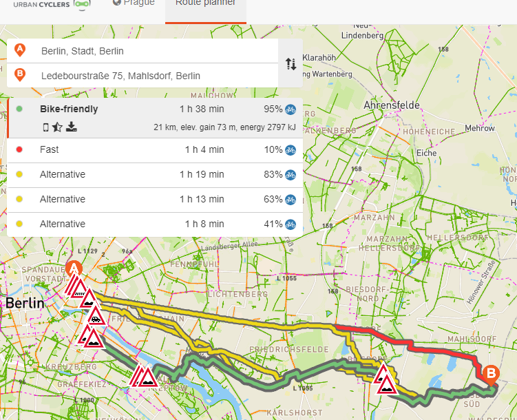
Finding the healthiest route planner
The demo application will illustrate just how the air quality model’s open data can be implemented in an app. Meanwhile, the scientific publication will serve as a manual for implementing the data in a scientifically sound manner in routing applications. Umotional has already developed multiple routing-apps for cyclists, including an app that displays the most cycling-friendly route. Those routes are based on safety, road type, digital elevation models, etc. The app is set to launch in September 2019 and will take into account nitrogen dioxide and/or soot in addition to existing criteria to display the most cycling-friendly route. Furthermore, it will also show the average air quality of any given route.